Floods Destroy Family Farm and Leave Something Unexpected
Guest post by John Grassy, Montana Department of Natural Resources
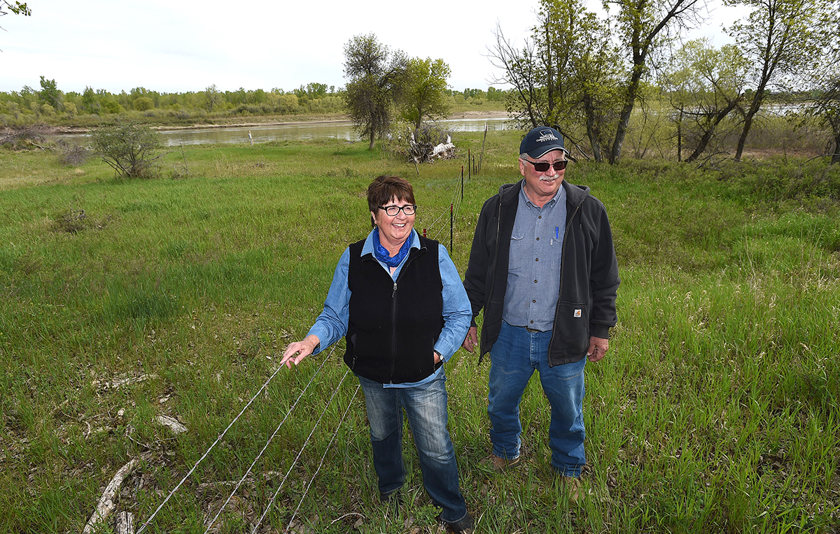
Connie and Dick Iversen stood on the high bluff, watching and wondering when it might end. It was June 2011. The Missouri River below them reached a record-high flooding. For the fifth time since its construction in the 1930s, the massive spillway on the Fort Peck Dam was open and gushing water. In the flood of 1975, a record 35,000 cubic feet per second (CFS) of water poured from the dam; in June 2011, the flow exceeded 100,000 CFS at the Culbertson gauging station.
Below the bluff, 1,500 acres of the Iversen’s farm near Culbertson drowned under water. Their crops for that year were gone. Four hundred acres of sugar beets, 600 acres of malt barley, and 400 acres of grazing land, gone. The ranch road, the fencing, a center pivot and irrigation system – even an old homestead – all of it was submerged beneath the roiling, mud-colored water.
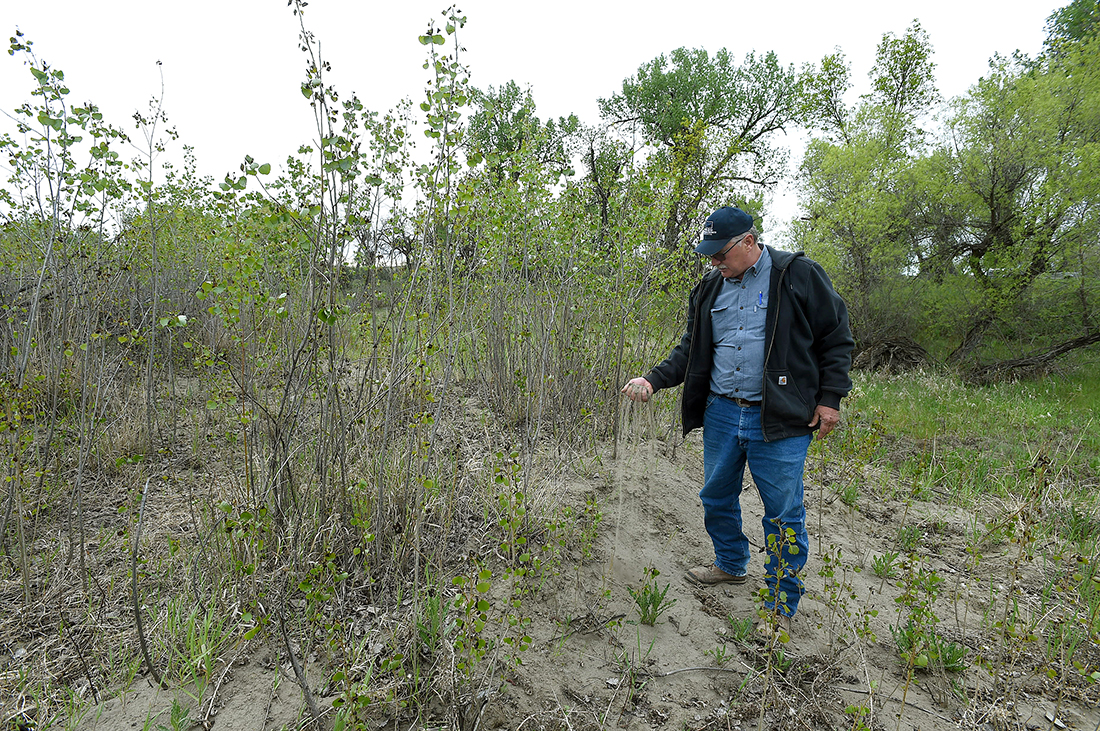
Dick and Connie Iversen look over farmland near Culberston that was flooded in 2011.
Photo taken by Larry Mayer, May 20, 2017
Dismayed, Dick says, “It wasn’t the place we had before,” once they returned to the farm.
“It was heart-wrenching,” Connie says.
Floodwaters scoured out craters in the fields, some 20 feet deep and a quarter-mile long; other areas were covered in sand dunes 20 feet high. The sandy ground hampered recovery. “Once we could get in, we spent a month pushing dirt,” says Dick. “We got every kind of heavy equipment you can imagine stuck out there.”
Once the initial phase of recovery began, the couple faced tough questions. “What do we do with this?” Connie asked. “We didn’t know at first. How do we fix things? How do we pay for it?”
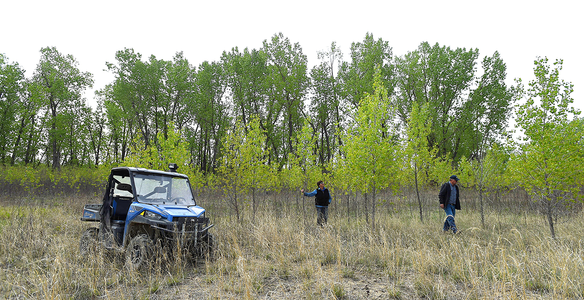
That fall, they found the first answer to their questions under their feet, spread across hundreds of acres. The flood robbed them of their crops, but left something behind: thousands of seedling cottonwood trees.
The Iversens knew that native cottonwood trees depended on flooding to regenerate forest. And on the Missouri River with its network of dams and reservoirs, a real flood was almost unheard of. Along their section of the river, “We had noticed cottonwoods were dying of old age and there wasn’t any new growth,” says Dick. “We thought, ‘this is our chance.’ We decided we better maintain what we had because we weren’t going to see it again in our lifetime. Whether we liked it or not, whether we could make money or not, it was important to preserve some of those trees.”
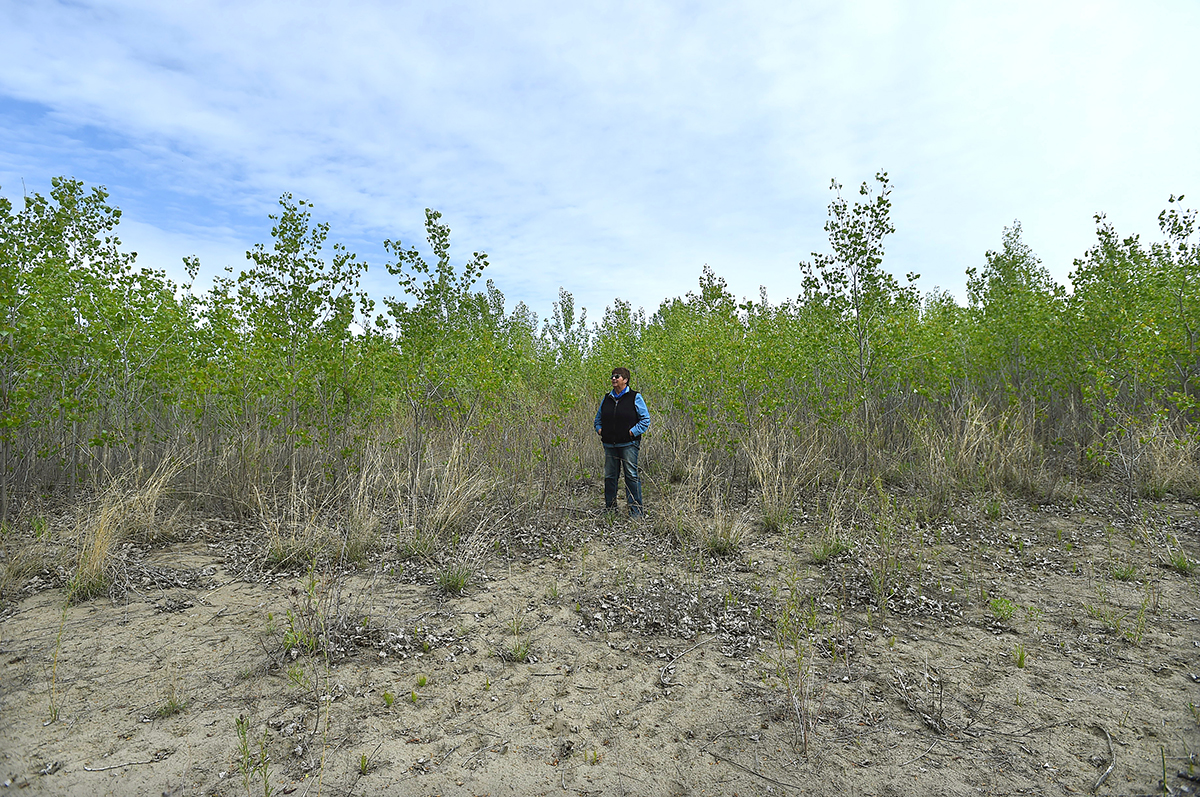
Dick and Connie Iversen look over farmland near Culberston that was flooded in 2011.
Photo taken by Larry Mayer, May 20, 2017
Rachel Frost is a coordinator for the Missouri River Conservation Districts Council (MRCDC). In recent years, she said, the council invested in programs that emphasize riparian areas – their importance to water quality, fish and wildlife, aesthetics, as well as their working functions for ranchers and farmers.
“Riparian areas belong to all of us,” said Rachel. “They’re important to people using rivers for recreation. They have a vital role in protecting water quality. In a broad sense, managing riparian grazing affects everyone in Montana. The council works with landowners to encourage best practices by providing the infrastructure, tools and technical assistance to do it right.”
One of those MRCDC programs, called Ranching for Rivers, offers 50 percent cost-share assistance for ranchers to develop their riparian pastures with improved fencing and other related infrastructure, such as water gaps and off-site water tanks. The program is supported by a grant from the Montana Department of Natural Resources and Conservation, the Natural Resources Conservation Services, and the Soil and Water Conservation Districts of Montana. The program debuted in 2016 and the Iversens would be among the first ranchers to use it.
The Iversens knew they wanted to conserve a large portion of the young cottonwoods, but first they had to assess and reconfigure the whole property. The blueprint for their new operation took shape through 2012 and 2013 as they filled in the craters, hauled off the sand dunes, razed the old homestead, and rebuilt their road and irrigation system. Much of their former cropland couldn’t be farmed; those areas were dedicated as new grazing land, or, in places where the young trees were abundant, set aside.
By 2016, they installed new fencing. To best manage their cows’ grazing activities in the riparian areas, Connie and Dick established a series of smaller pastures, some of which included dense thickets of young trees. “With the smaller pastures, they can easily move cows in and out of riparian areas,” Rachel said. “In some areas with new trees, the cows are completely excluded. In other pastures, grazing will be used to thin out some of the trees and promote development of forage – grasses, forbs, shrubs.”
During the flood, Connie and Dick noticed how floodwaters impacted areas with healthy populations of willows, cottonwoods, and native shrubs compared to areas where vegetative cover was absent. “Where there were trees, the riverbanks did much better – there was a lot less erosion,” said Dick. “As the new trees mature those areas are going to be more resilient.”
Dick and Connie Iversen look over farmland near Culberston that was flooded in 2011.
Photo taken by Larry Mayer, May 20, 2017
Since its inception, Ranching for Rivers has worked with nine landowners, eight of them on the Missouri River. The resulting changes in management activities will benefit more than eight miles of river corridor, reducing soil erosion, improving wildlife and fisheries habitats, and combating invasive weeds. Recreation and scenic value improves and it eases the ability of landowners to manage their livestock and grazing.
Today, on the Iversen’s place, those cottonwood trees delivered by the flood are twenty feet tall. Native grasses like cordgrass and Canadian wild rye, as well as native shrubs and forbs – which weren’t present before the flood – have come in. “I’ve always wondered what grasses and other plants Lewis and Clark saw when they came through,” Dick says. “We want to keep all of those native species in the understory.”
Dick and Connie Iversen look over farmland near Culberston that was flooded in 2011.
Photo taken by Larry Mayer, May 20, 2017
“In another 50 years this is going to be a pretty impressive sight,” Connie says. “It’s a miracle we were able to put this place back together.”